OneButton Standard
Get OneButton Standard Now...
Aerial Imagery / Rapid Growth
New Applications
Fueled by worldwide Unmanned Aircraft Systems (UAS) market growth, and miniaturized inexpensive sensor evolution, aerial imagery is now cheaper and easier to capture than ever before. The processing of that imagery into GIS (Geographic Information System)-compatible maps is also evolving rapidly and dropping in cost. These developments have combined to provide a broad range of new applications and decision support capabilities.
OneButton Supports any Frame Sensor (mechanical shutter preferred)
Some examples:
- 12MP and 24MP DJI Sensors
- 36MP Nikon and Canon Sensors
- 50MP and 100MP PhaseOne RGB Sensors
- FLIR and TeAx thermal Sensors
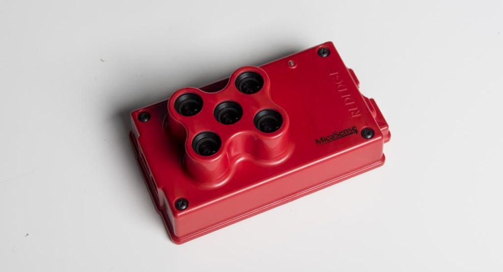
- Multispectral sensors from MicaSense and Agrowing.
- 195MP to 280 MP Intergraph and Vexcel – 4-band RGB/NIR sensors.
- Leica Citymapper RCD30
Easiest-To-Use Image Processing Software
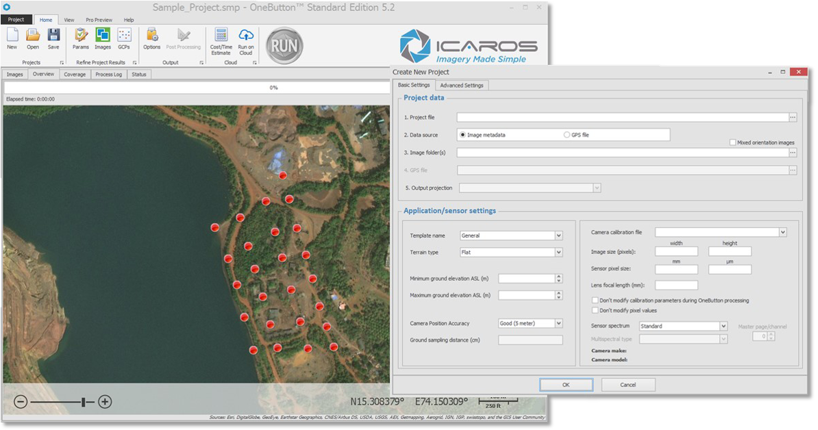
The Icaros OneButton™ software is by far the industries’ easiest-to-use image processing product. By utilizing the most advanced photogrammetric and computer vision algorithms, OneButton™ lets you easily and automatically create fully georeferenced products in 2D and 3D, while combining highly optimized performance to produce exceptionally fast and accurate results.
Many Output Options
Outputs that can be produced from OneButton™ include orthomosaics, DEMs (Digital Elevation Models), true color 3D point clouds, orthorectified multispectral band mosaics, controlled oblique imagery and thermal orthomosaics.
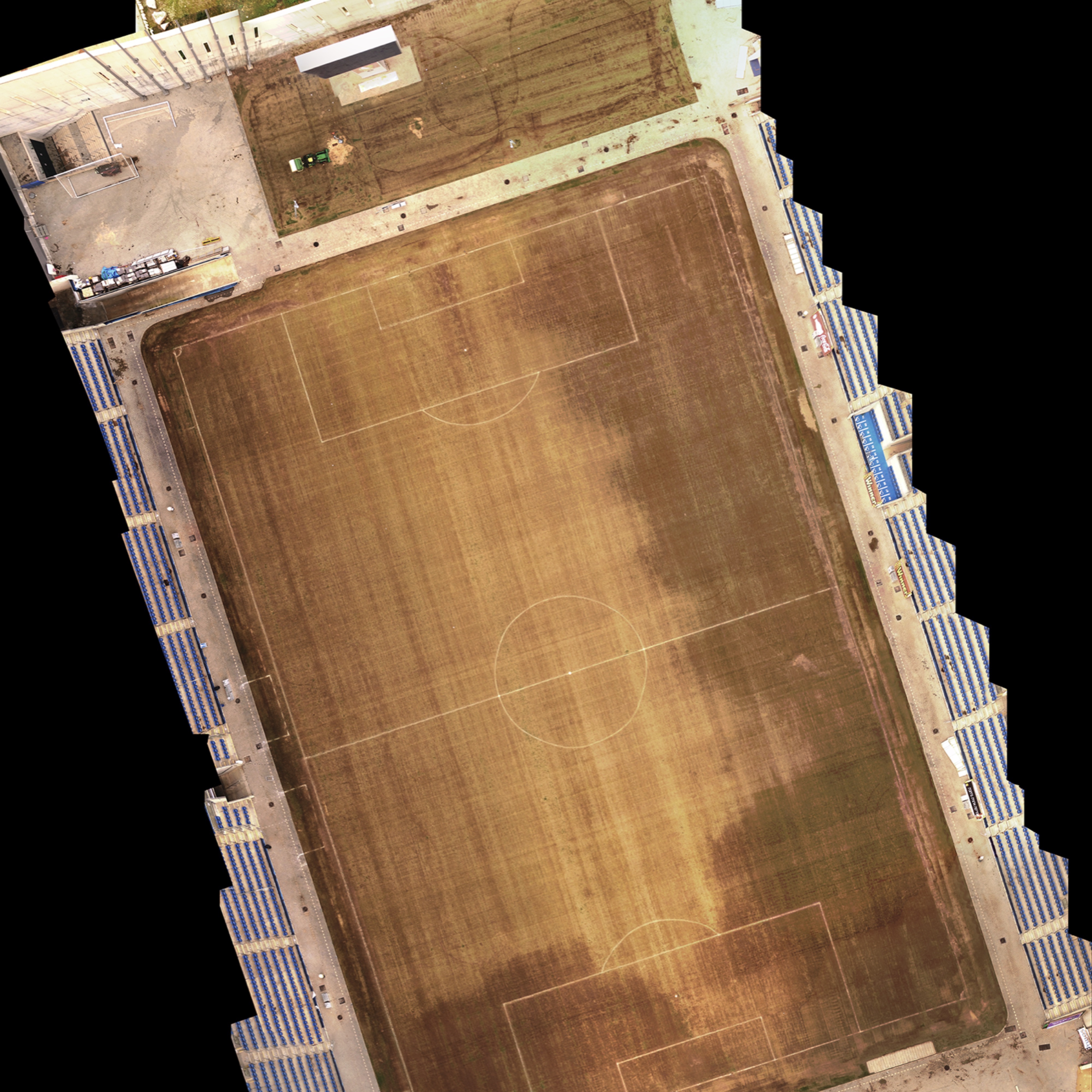
Photo: Orthomosaic created from aerial imagery collected by DJI Phantom UAV. The stadium at right took 6 minutes to process in 2cm GSD.
Perfect Orthomosaics
OneButton™ orthomosaics are produced from overlapping aerial images that it stitches together and geometrically corrects (“orthorectifies”) to give them a uniform scale. This process removes perspective distortion from the aerial images, making the resulting “mosaic” a map that can be accurately measured and analyzed.
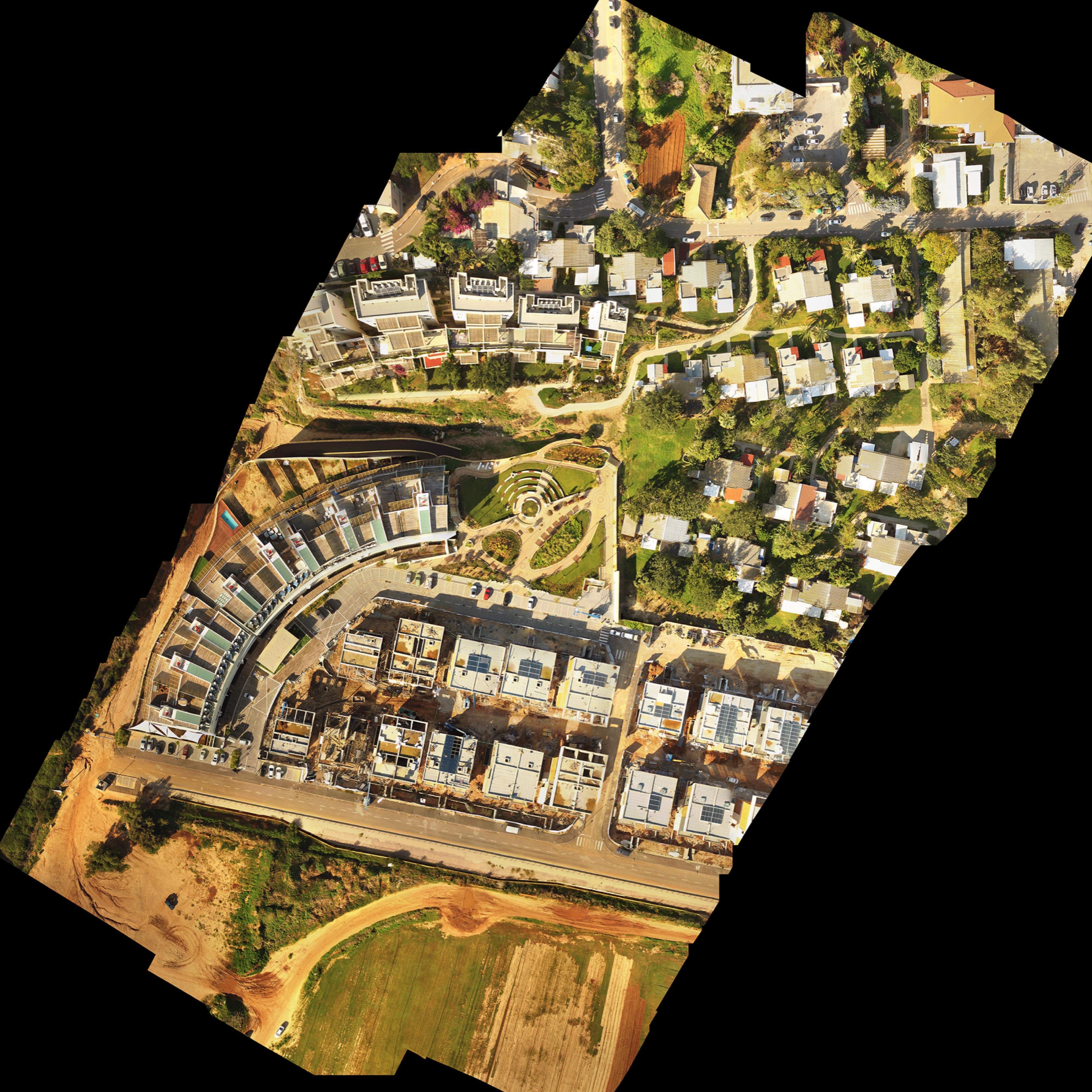
Photo: Orthomosaic of a residential housing subdivision shot from DJI Phantom. Total time to process was 49 minutes
GIS Ready
Processed georeferenced and orthorectified imagery products are output in a form that can be automatically ingested into Geographical Information Systems (GIS) and analytics packages such as MapInfo, ArcMap, MapBox, QGIS, ENVI, supporting complex analytics for applications including precision agriculture; pipeline inspection; real estate visualization; construction, engineering projects; and many others.
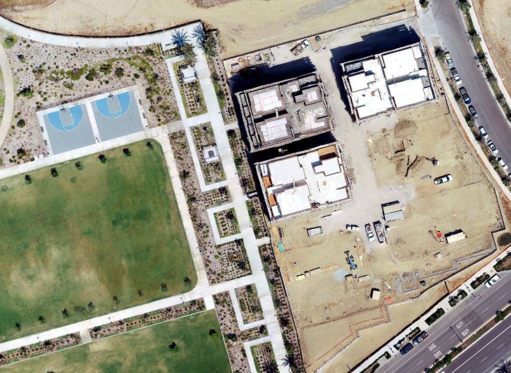
Photo: TrueOrtho orthomosaic for construction management. Source images are DJI FC6310S 20MP used to produce a 2cm final product.
Immediate ROI
Regardless of your experience, OneButton™ lets you immediately increase ROI and begin building exciting new applications, and dramatically lowers the cost of ongoing data collection and processing for existing applications.
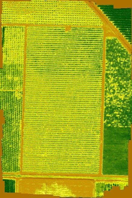
Photo: Multispectral orthomosaic showing orchard conditions using NDVI. Source images are MicaSense RedEdge M sensor.
OneButton™ Standard Features & Benefits
- Extremely easy to use saving both time and money, and leveraging your workforce for better productivity and growth
- Options for various project types which optimizes the photogrammetric process.
- True orthomosaic images can be produced for more accurate results in urban areas and for survey grade projects.
- Product viewer shows 2D outputs (GeoTiff orthomosaic & terrain model), 3D outputs (LAS point cloud, PLY photomesh), fly throughs, and contour lines.
- Go from collected images to seamless orthorectified, geospatially accurate products (digital elevation models, orthomosaics, 3D point clouds) within minutes
- Fully automated image-stitching, feathering, light and color balancing for exceptional results
- Supports entry (or import) of ground control points (GCPs) for high geolocation accuracy projects such as engineering and construction.
- Indifferent to camera, lens, and external orientation parameters
- Supports small and medium, as well as large format sensors for efficient coverage of large areas
- Enhanced matching algorithm for images with low overlap and projects with areas having images with no connections between them
- Flight altitude can be calculated above ground and corrected if needed to significantly enhance results when sensor metadata is incorrect
- Ground Control Points can be sampled before or after bundle block adjustment and be assigned a specific accuracy for XY and Z
- Multi-band alignment for MicaSense images allowing for alignment of bands for each GPS location and create multi-page Tiff images
- Supports output to BigTiff format
- High-performance, state of the art photogrammetric engine incorporates the latest Computer Vision and Structure from Motion technologies to produce exceptional 2D and 3D results
- Real time progress, auto-save and recovery capability
- Utilizes GPU and multiple cores (if present) for very fast processing
- Supports data from highly accurate GPS receivers (e.g., PPK)
- Supports multispectral multiband & thermal imagery from a variety of sensors
What is New in OneButton™ Standard
- Cloud Processing – can really help to reduce time to process projects with access to multiple computers. Purchase project by project with no monthly fees.
- Icaros is now offering the ability to subscribe to both desktop editions of OneButton Standard and Professional monthly.
- New sensor support: FLIR Duo R, MicaSense RedEdge M, TeAx, Agrowing, and many others added to our database.
- MicaSense – full support of sensor, Downwelling Light Sensor (DSL), and Reflectance Panels.
- New – produce final vegetation image products using 10 pre-programmed reflectance and vegetation indices with the ability to add your own custom indices.
- New – produce True Temperature Mosaics from the TEAX FLIR Sensors and FLIR Duo R sensors. Averaged temperature mosaics can also be produced by OneButton.
- Clone Subset Project – used to assist in quicker processing times as you test project settings.
- Pre-calibration – process runs at beginning of workflow to define camera calibration for sensors that do not have a factory or professional calibration file.
- Camera Calibration file produced as a result of the aerotriangulation process can be used as input for processing your next image set from the same sensor.
- Improvements to True Orthos processing and output products.
- Now supports corridor mapping.
- Project Setup
- Can now enter sensor pixel size as millimeters or microns for easier data entry.
- OneButton filters images by kappa angles to help remove images not needed for processing (e.g., images captured in the turns between flight lines).
- Auto-kappa Calculation – OneButton automatically determines the direction of flight.
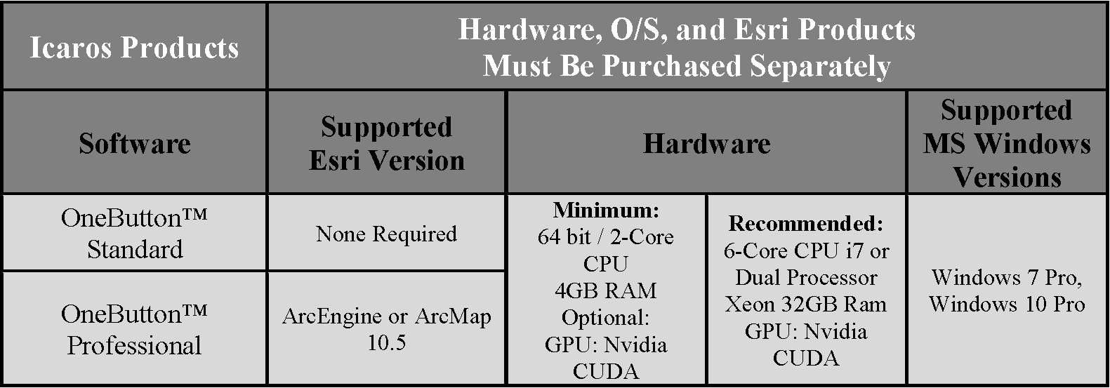
Computing Environment Requirements